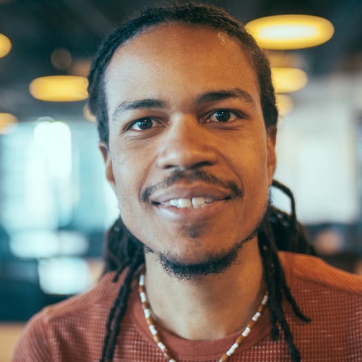
Mjumbe Poe
Verified Expert in Engineering
Civic Engagement Developer
Mjumbe uses technology as a tool to help build the capacity of individuals and communities to shape their cities, their neighborhoods, and their own lives. For the last decade, he's primarily worked in web stacks with Python and JavaScript at the core. Mjumbe also has experience in several other languages and is committed to using the best tools in context.
Portfolio
Experience
Availability
Preferred Environment
GitHub, Atom, Ubuntu, Python, PostgreSQL, Linux
The most amazing...
...business I've co-founded was a real estate analytics startup where we developed interactive visualizations explaining the context around potential investments.
Work Experience
Founder | Urban Technologist
Poe Public
- Implemented participatory budgeting maps for the city council of NYC. Thousands of ideas are submitted across 20+ participating council districts each year. Also worked on participatory budgeting projects with Long Beach, CA, Greensboro, NC, and Cambridge, MA.
- Developed idea collection maps for Miami Foundation's public space challenge. This included a rating/judging component through which they determined how to allocate $300,000+ each year.
- Worked with the NYC city council to vet and provide suggestions for improvements on their legislative management system (Legistar) API.
- Created a map-based survey to prepare the bicycle transit systems and the city of Los Angeles's bike-share rollout.
Data Engineer
Betterment
- Led the transition of the service provider used for syncing data from eight upstream financial application databases (PostgreSQL and MySQL) to the data warehouse (Redshift).
- Planned and led a thorough data validation process for testing the correctness of synced data and accounting for varying assumptions between different data syncing providers.
- Established patterns for modeling data transformations using DBT, replacing legacy, home-grown patterns.
Co-founder | CTO
Stepwise Analytics
- Oversaw the development of Stepwise's applications and guided the company's overall technology strategy.
- Created a system to generate detailed, data visualization-rich automated reports for every property across the cities the company supports.
- Built a vector tile server to dynamically render tiles based on queries across hundreds of thousands of properties.
- Constructed data exploration tools to help company developers understand the historical accuracy of their machine learning models at any point.
- Decreased the number of errors in the company's property valuation models by 50%.
Digital Services Architect
City of Philadelphia, Open Data & Digital Transformation (ODDT)
- Researched, designed, and developed processes and tools to help city departments collect, use, and release data.
- Developed an interim homeless management information system for the Office of Supportive Housing to help them avoid regressing to a paper-based data collection system which would have jeopardized their ability to deliver HUD reports required for a significant portion of their funding.
- Implemented an interactive data visualization of occurrences of “bullet voting”—when voters choose only one of five allowed candidates for at-large council positions—during the 2015 city council primary election. The visualization allowed the city controller’s office to communicate a confusing phenomenon to the general public.
- Researched and began designing processes to centralize deployment, management, and reporting around the City’s ETL pipelines. Based on the challenges that ODDT faced around ETL, identified, and began implementing an instance of Airflow. Also began documenting recommendations on how ODDT should be building ETL scripts, using petl as a data transformation and validation library.
Software Developer
OpenPlans
- Worked on a small team with amazing people on projects that empower people to get involved in planning for the future of their communities and cities.
- Helped to develop Shareabouts, a flexible tool for gathering geography-specific public input. Primarily responsible for developing the Django REST framework-based Shareabouts data server, reporting tools, and core parts of the mapping interface.
- Built a product called OpenPlans, an outgrowth of our experience building tools and websites for urban planning projects. Worked on many parts of this project: server-side data management, external service integration, APIs, browser-side interface development, and testing.
Experience
Shareabouts
https://github.com/openplans/shareaboutsShareabouts is used by governments and public interest organizations throughout the United States. I was the original author and continue to be a primary maintainer of the platform.
Django REST Framework CSV
https://github.com/mjumbewu/django-rest-framework-csvI originally developed this plugin for the Shareabouts project, and I continue to maintain it. It has become a popular project, as API CSV-generation is a need more common than I initially anticipated.
Councilmatic
https://www.councilmatic.org/Cyborg City
https://github.com/mjumbewu/cyborg-city-presentationIn these presentations, I embodied a historian from the year 2056 looking back at the developments in the relationship between humans and digital technology over the first quarter of the 21st century. The first presentation was given at DjangoCon 2016, and I spoke about the process at Ignite Philly 19.
Skills
Languages
JavaScript, Python, HTML, CSS, SCSS, SQL, R
Frameworks
Django, Django REST Framework, Flask, Django Channels
Libraries/APIs
Leaflet, C3.js, Backbone.js, jQuery, Pandas, Vuex, Vue, D3.js, Scikit-learn, Marionette.js
Tools
Chrome Developer Tools, Git, GitHub, Web GIS, Celery, Webpack, Atom, Apache Airflow
Platforms
Linux, Mapbox, Heroku, Ubuntu, Kubernetes, Docker
Storage
PostGIS, PostgreSQL, Redis, Redshift
Other
Software Development, Geospatial Data, Civic Engagement, Engineering Management, Data Build Tool (dbt), Project Leadership, Data Visualization, Supply Chain Management (SCM)
Paradigms
Test-driven Development (TDD)
Education
Fellowship in Technology and Democracy
Harvard University - Cambridge, MA, USA
Fellowship in Civic Technology
Code for America - San Francisco, CA, USA
Bachelor of Science (BSc) Degree in Computer Science
Harvey Mudd College - Claremont, CA, USA
How to Work with Toptal
Toptal matches you directly with global industry experts from our network in hours—not weeks or months.
Share your needs
Choose your talent
Start your risk-free talent trial
Top talent is in high demand.
Start hiring